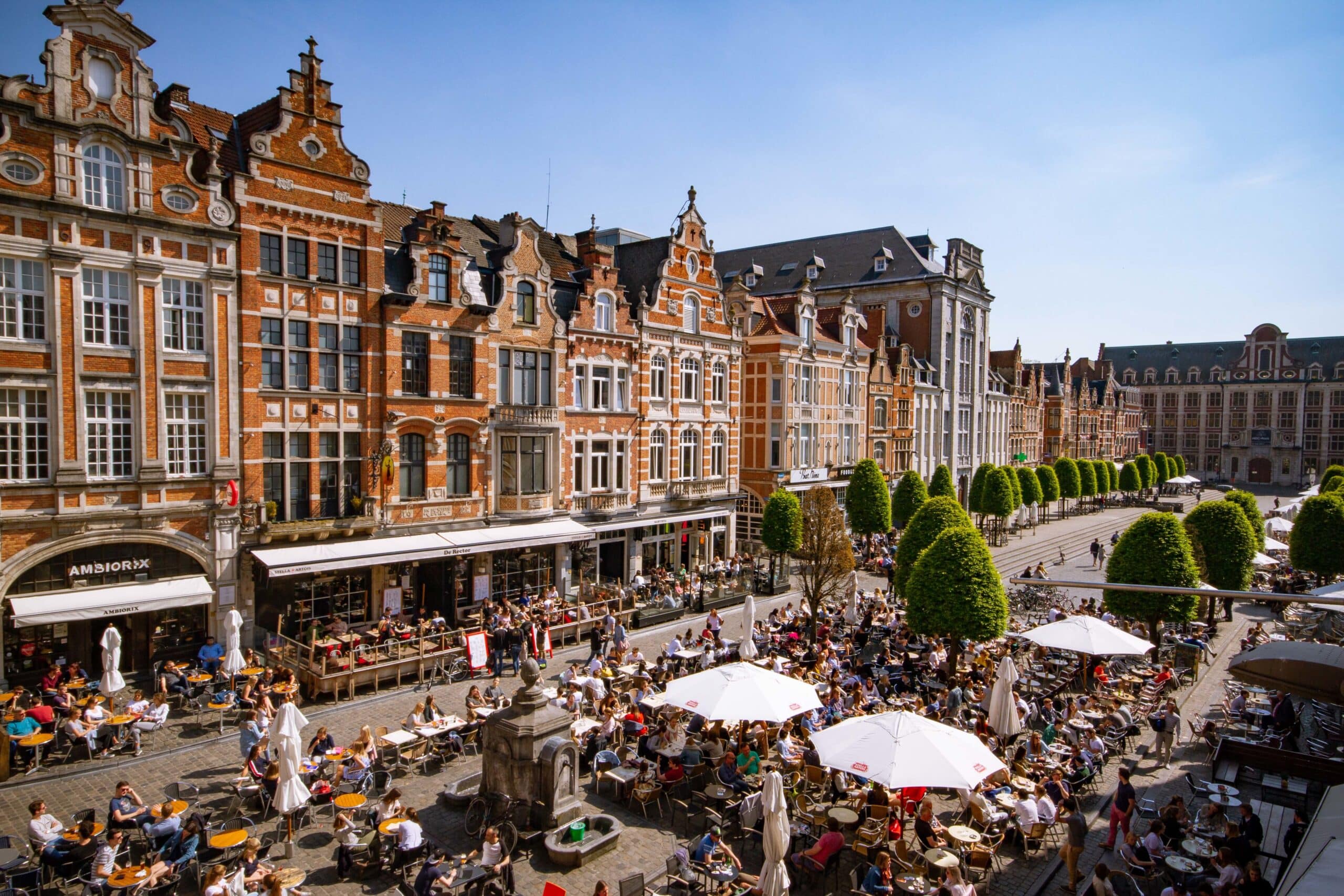
Leuven, Belgium | 30 June – 2 July
Background
Article 8 of the EU Nature Restoration Regulation introduces binding targets for urban ecosystems. Member States must ensure no net loss of the total national area of urban green space and urban tree canopy cover by 2030, followed by a positive increasing trend thereafter.
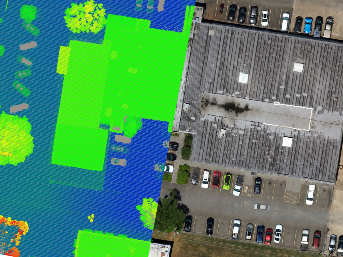
The European Commission proposes a standardised monitoring workflow based primarily on datasets from the Copernicus Land Monitoring Service (CLMS). However, several regions have access to higher-resolution and potentially more accurate regional geodata. This creates a strategic and methodological question: Should regions strictly follow the EU-standard workflow for harmonisation, or can regional high-resolution datasets be used to produce more locally accurate estimates – while remaining compatible with EU reporting requirements? Additionally, can we develop a harmonized pan-European methodology for monitoring both urban green and urban canopy cover using open earth observation data?
Overall goal & methodology
During this 3-day hands-on workshop, we will co-develop a harmonised, multi-level monitoring workflow for urban green space and canopy cover that can support the 6-year reporting cycle. The workflow will be tested on at least two large and two small European cities.
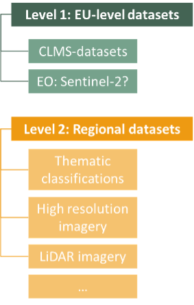
- Level 1: Harmonized pan-European monitoring workflow
Key question: How can urban green space and tree canopy cover be monitored in a harmonized way across Europe?
Methods: Compare EU standard datasets (Copernicus Land Monitoring Service) with freely available earth observation data
- Level 2: Regional / local monitoring using high-resolution datasets
Key question: What is the added value of regional high-resolution data for local estimates, and how do these compare to pan-European indicators?
Methods: Compare pan-European data with regional high-resolution geodata + develop a multi-level harmonized workflow showcasing how different remote sensing datasets can be used to quantify urban green cover and canopy cover.
This workshop aims to explore and compare these different approaches and distil a harmonized methodology/monitoring framework that can be implanted by member states. Ideally, we lay the groundwork for a joint publication in policy-oriented scientific journal.
Format & expectations
This is not a traditional training school, as there will be no lecture-style sessions. Instead, this is a hands-on, collaborative workshop in a small group (maximum 8 participants). We are looking for motivated and proactive PhD candidates and postdoctoral researchers with experience in urban remote sensing, object-based classification of high-resolution imagery, LiDAR processing, NDVI and vegetation indices. Participants should be comfortable working independently and contributing actively to group outputs.
Practicalities
The workshop will take place in Leuven, Belgium from June 30th – July 2nd. Participation is limited to eight participants, and a selection procedure will be applied. We welcome applications from PhD candidates and postdoctoral researchers in environmental sciences, geography, geo-ecology, ecology, or related fields, with relevant methodological expertise.
There is no registration fee. COST action will reimburse the costs of selected participants’ travel, accommodation and subsistence. Only applicants from COST countries (https://www.cost.eu/about/members/) are eligible for reimbursement. The costs will be reimbursed only after the summer school is completed. Applicants from outside these countries can also apply, but they must provide their own funding.
How to apply
Please complete the application form: https://forms.gle/HwNVisgbf4CLkNZFA
You will be asked for short motivation/background letter (in which your relevant expertise should be stated), CV, and abstract of current work.
Evaluation of applications
Applications will be evaluated by the organising committee based on scientific relevance, motivation, and technical experience. Particular attention will be paid to the applicant’s motivation letter, the relevance of the applicant’s current research to the topic, experience with urban remote sensing, object-based classification of high-resolution imagery, LiDAR processing, NDVI and vegetation indices.
Additional criteria include career stage (with priority given to early-stage researchers), interdisciplinarity, and the overall balance of countries, institutions, and expertise to ensure a diverse and productive group of participants.
Applicants from COST countries will be prioritised for reimbursement in accordance with COST rules. In case of similar evaluation scores, diversity considerations and practical contribution to the workshop activities may be used as tie-breaking criteria.
Motivation Letter (10p); CV (3p); Abstract (5p); Research interest (5p); Position (3p)
Important dates
- Call opens: March 2026
- Application deadline: April 27th 2026
- Notification of results: no later than May 11th 2026
Questions
For questions, please contact: eva.beele@kuleuven.be, dieter.anseeuw@vives.be and bregt.roobroeck@vives.be
Call for high-resolution urban datasets – Workshop monitoring urban ecosystems for Article 8 of the EU Nature Restoration Regulation Contribution
In the context of our upcoming workshop on monitoring urban ecosystems for Article 8 of the EU Nature Restoration Regulation, we are currently seeking regional high-resolution datasets to support the hands-on analyses. For additional info, please check the post for the call here.