Bratislava 3D Urban Tree Intelligence Hackathon
Date: 1–5 June 2026
Location: Bratislava, Slovakia
Main organiser: Institute of Geography, Slovak Academy of Sciences
1. Background
The Bratislava 3D Urban Tree Intelligence Hackathon was organised as an international implementation testbed focused on the use of 3D point clouds, LiDAR sensors, mobile mapping systems, low-cost scanning prototypes and processing workflows for practical urban tree management.
The activity was developed within the framework of COST Action CA23148, whose broader objective is to support more harmonised, comparable and practically useful approaches for assessing, monitoring and managing urban forests. The hackathon was not conceived as a standard scientific meeting or a small technical demonstration. Instead, it was organised as a hands-on field and processing activity in real urban conditions, with the aim of testing the full chain from data acquisition to practical urban forestry outputs.
The main objective was to evaluate how different 3D sensing technologies and point-cloud processing workflows can contribute to urban tree inventories, tree-level measurements, crown assessment, repeatable monitoring, benchmarking of methods and future guidance for municipalities. Particular attention was given to the practical needs of city tree managers and to how 3D-derived tree information can support evidence-based urban forest planning.
The activity was hosted and coordinated by the Institute of Geography of the Slovak Academy of Sciences on behalf of COST Action CA23148, the City of Bratislava, academic participants, technology providers and private-sector partners.
2. Relevance to COST Action
The hackathon directly contributed to the aims of COST Action INTUF by testing methods and workflows that can support the development of practical, harmonised, and comparable urban forest indicators. The activity addressed one of the central challenges in urban forestry: cities need better information not only on where trees are located, but also on their three-dimensional structure, condition, crown dimensions, growth form and potential ecosystem-service contribution.
The event therefore contributes to the COST Urban Forestry Network by providing a real-world example of how research, municipal stakeholders and technology providers can work together to test emerging tools for urban forest monitoring. The results are relevant to several INTUF objectives, including:
· development of parameters and methods for urban forest assessment;
· benchmarking of technologies and workflows;
· support for automated analysis and digital tools;
· integration of tree-level measurements with broader city-scale spatial datasets;
· preparation of practical guidance for municipalities;
· development of policy-facing and professional outputs.
The hackathon also addresses the need to make urban forest assessment more transferable across cities. Although the fieldwork was conducted in Bratislava, the methods, data standards, protocols and evaluation framework are intended to be reusable and adaptable in other European cities and beyond.
3. Study sites and urban conditions
During the hackathon, participants scanned 17 selected sites across Bratislava. These sites covered more than 700 urban trees and represented a wide range of real urban configurations. The selected situations included street trees, trees on sidewalks, trees between roads, trees close to buildings, park trees, embankment trees, isolated trees, tree groups, trees with overlapping crowns, and trees growing in structurally complex urban environments.
This diversity was essential for the activity. Urban trees are rarely measured in ideal conditions. They are often affected by occlusion from buildings, vehicles, street furniture, shrubs, other trees and public infrastructure. By testing the technologies in these real-world conditions, the hackathon generated evidence more relevant to practical urban forest management than a controlled laboratory comparison.
Bratislava provided a particularly suitable test environment due to the availability of municipal tree data, existing spatial datasets, local expertise, ground-control support, opportunities for airborne and drone-related data, and direct engagement with municipal representatives responsible for greenery planning and urban vegetation management.
4. Participants and international dimension
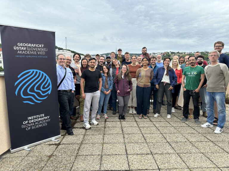
The hackathon brought together a broad international group of participants from research institutions, municipalities, companies, and technology providers. More than 90 people applied to take part, of whom 14 were selected for reimbursement of travel and accommodation costs, alongside 5 lecturers. In the end, 32 researchers registered on-site, demonstrating strong self-funded interest in attending and confirming the clear demand for this type of event. The participants represented several countries, including Slovakia, Germany, United Kingdom, Spain, Finland, Belgium, Poland, Italy, France, Czech Republic and Uruguay.
The participant group included researchers, urban forestry specialists, geoinformatics experts, point-cloud processing specialists, hardware developers, software developers, technology providers and municipal stakeholders. This interdisciplinary and cross-sectoral structure was one of the strongest aspects of the activity.
The involvement of companies and technology partners was particularly important. The activity included contributions from RIEGL, Mandeye, Xplore4D, CEDA, Photomap, Geotech, Expert for Landscape and Lidaretto. Their participation enabled the hackathon to compare a wide range of hardware platforms and to discuss not only scientific outputs but also operational feasibility, acquisition logistics, processing requirements, and possible implementation pathways for cities.
5. Hardware and scanning systems tested
A major output of the hackathon was the deployment and comparison of a broad set of scanning systems. In total, approximately 28 different laser-scanning and point-cloud-acquisition systems were used or represented during the activity. These included static terrestrial laser scanners, kinematic terrestrial systems, car-based mobile mapping systems, handheld scanners, backpack or shoulder-mounted systems, bicycle-based or mobile systems and low-cost prototypes.
The systems included, among others:
· RIEGL VZ-400i;
· RIEGL VZ-600i in static, kinematic and car-based configurations;
· RIEGL VMX-2HA;
· FARO 350;
· Leica RTC360;
· Leica BLK360;
· Leica BLK2GO;
· Hovermap RTK and non-RTK configurations;
· 3DMakerPro;
· GeoSLAM;
· FARO Orbis;
· Lidaretto handheld and car-based systems;
· XGRIDS Lixel L2 Pro;
· several low-cost and prototype systems, including AVIA, HAP, Hesai JT16, Hesai XT32, Mandeye D, Mandeye MR, Mandeye Pro, SICK multiscan, VIP and Hesai JT128.
The wide range of platforms allowed participants to compare not only point-cloud density and quality, but also acquisition speed, ease of use, georeferencing, occlusion behaviour, field logistics, processing burden, repeatability and suitability for extracting tree-level urban forestry indicators.
This technological diversity is highly relevant for cities, as municipalities and urban forestry teams are currently confronted with many options but often lack independent evidence on which systems are suitable for which tasks.
6. Data collected and preliminary outputs
The hackathon generated approximately 2.8 TB of tree-related point-cloud data. The data cover more than 700 trees across 17 urban sites and were collected using a combination of terrestrial, mobile, handheld, car-based and low-cost scanning systems.
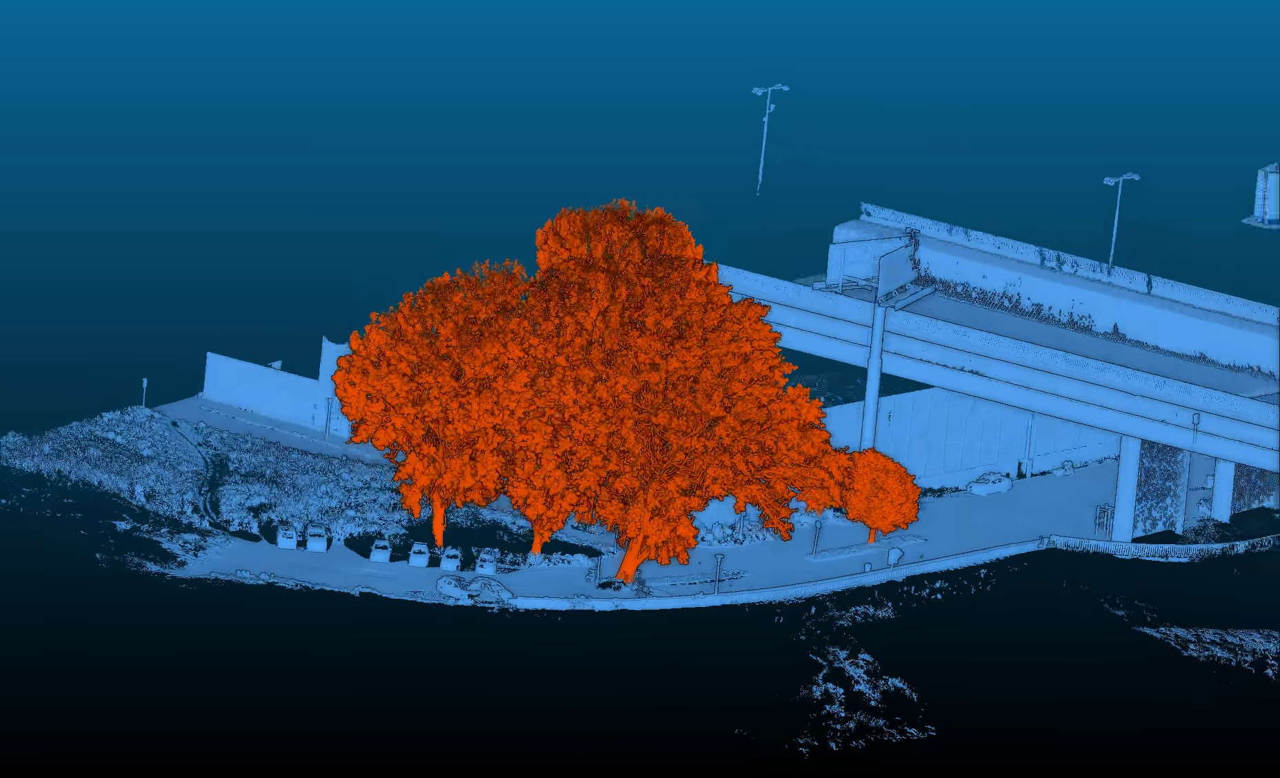
The collected data are already proving valuable for both scientific and practical purposes. Preliminary outputs include point-cloud visualisations, aligned datasets, initial demonstrations from participating companies, and materials prepared for the post-hackathon wrap-up discussion. Contributions from Geotech / Leica and CEDA, as well as preliminary video demonstrations, illustrate the potential of the dataset for urban tree inventory, crown assessment and practical use cases.
The main data processing is expected to continue through two Short-Term Scientific Missions. These STSMs are expected to focus on the preparation, harmonisation, processing, and evaluation of the collected point cloud data. The results should provide the basis for further methodological outputs, benchmarking tables and possible scientific publications.
7. Stakeholder relevance and practical value
A key strength of the hackathon was the direct involvement of practical stakeholders. The main user interest comes from the City of Bratislava, which is interested in how the outputs can support better urban tree management, more objective tree measurements, improved valuation, crown assessment, planning and monitoring of urban greenery.
Discussions with municipal representatives highlighted several practical needs. Trees are costly to maintain, legally protected and important for the quality of urban life. At the same time, many existing valuation and assessment models are outdated, and some important parameters, such as crown width, are still often estimated visually rather than measured objectively. The hackathon directly addressed these limitations by testing whether laser scanning can provide more objective and repeatable information on tree height, DBH, crown dimensions, crown overlap, crown volume, structural condition and surrounding urban context.
The outputs are also of interest to Google Research, particularly in relation to emerging AI-based methods for mapping trees outside forests and improving tree-related spatial datasets. This strengthens the international technological relevance of the Bratislava dataset.
8. Contribution to urban forest indicators and WG1/WG2 objectives
The hackathon provides a valuable contribution to the INTUF indicator framework, especially regarding tree structure, tree vitality, canopy assessment, and the integration of detailed tree-level data with citywide indicators.
For WG1, the activity is particularly relevant to indicators such as tree health condition and vitality, canopy cover, microclimate regulation, tree equity, greenspace accessibility, infiltration capacity and soil sealing. The hackathon does not claim that ground-based point clouds alone can provide all citywide urban forest indicators. Instead, its value lies in providing a detailed structural reference layer at the individual-tree scale.
This is especially important for the relationship between ground-based 3D data and airborne or spaceborne data. Many indicators, such as canopy cover, cooling, greenspace accessibility, tree equity and soil sealing, require wall-to-wall spatial datasets from airborne LiDAR, aerial imagery, satellite products or municipal GIS layers. However, ground-based 3D point clouds can calibrate, validate and interpret these broader datasets by providing detailed measurements of individual trees, crown form, stem structure and local urban context.
The hackathon therefore supports the development of an integrated approach: airborne and spaceborne data provide citywide coverage, while terrestrial and mobile scanning provide the fine-scale structural detail needed to understand, validate and improve those products.
For WG2, the activity is relevant to practical implementation, data processing workflows, digital tools, stakeholder engagement and possible synergies with ongoing tasks related to urban forest assessment and operational use.
9. Expected outputs and follow-up
The hackathon has generated the core ingredients needed for several important outputs of INTUF. These include a large multi-device dataset, a heterogeneous set of real urban sites, strong stakeholder engagement, involvement of technology providers, preliminary processing results and clear links to INTUF indicators and deliverables.
Expected output includes:
· a methodological report on the Bratislava hackathon and its contribution to INTUF objectives;
· benchmark tables comparing scanning systems and workflows;
· field, metadata, ingest and quality-assurance protocols;
· tree-level outputs such as detection, catalogues, DBH, height and crown parameters;
· guidance for municipalities on when and how to use 3D scanning for urban tree assessment;
· a policy brief on the value of structural tree information for urban forest management;
· scientific publications on dataset creation, benchmarking, urban tree indicators and practical applications;
· training materials, workflow documentation and visual demonstrations.
10. Conclusions
The Bratislava 3D Urban Tree Intelligence Hackathon was a major activity within COST Action CA23148 INTUF. It successfully brought together researchers, municipalities, technology providers and companies to test 3D urban tree monitoring in real city conditions.
The activity demonstrated that detailed 3D point cloud data can provide important information on individual tree structure, crown dimensions, urban context, and potential ecosystem service indicators. It also showed that these data should be understood as part of a broader urban forest monitoring framework, where ground-based measurements complement airborne LiDAR, drone data, aerial imagery, satellite products, municipal inventories and socio-spatial datasets.
The hackathon created a unique dataset, tested a wide range of scanning systems, engaged relevant stakeholders and generated strong potential for scientific, technical and practical outputs. Its results are relevant not only for Bratislava, but also for other cities seeking more objective, repeatable and comparable methods for urban tree assessment.
The activity therefore represents an important contribution to INTUF deliverables, especially in relation to harmonised methods, benchmarking, urban forest indicators, automated analysis, digital tools, municipal guidance and policy-facing outputs.