(Workshop monitoring urban ecosystems for Article 8 of the EU Nature Restoration Regulation Contribution)
In the context of our upcoming workshop on monitoring urban ecosystems for Article 8 of the EU Nature Restoration Regulation, we are currently seeking regional high-resolution datasets to support the hands-on analyses.
In particular, we are looking for European case study regions where the following datasets are available:
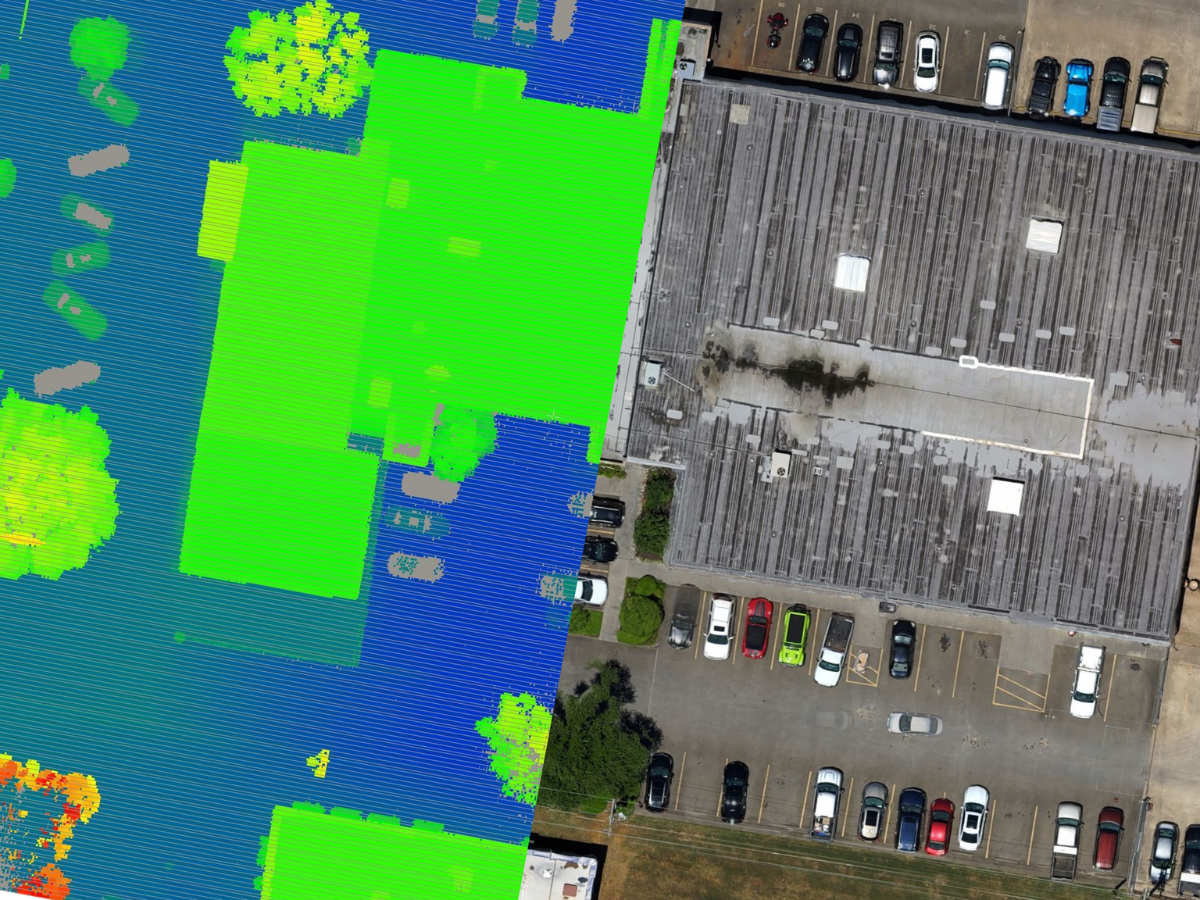
- high-resolution orthophotos (preferably <1 m spatial resolution, including RGB and NIR bands),
- LiDAR point clouds (raw data, medium to high density, ideally ≥15 points/m²), and
- detailed thematic land cover classifications that distinguish at least between tree canopy (high green), low vegetation, and agricultural land (preferable <10m spatial resolution)
Ideally, all three datasets are available for the same region to enable integrated analysis. Datasets should be accessible under an open or public sector license (e.g. Creative Commons CC BY 4.0 or equivalent), allowing free use without payment and with appropriate attribution. Ideally, the methodology will be tested across two small and two large European cities.
If you are able to contribute relevant datasets, please fill in the following form: https://forms.gle/hd9LsZFy7kopdKRs5
For questions, please contact: eva.beele@kuleuven.be, dieter.anseeuw@vives.be and bregt.roobroeck@vives.be